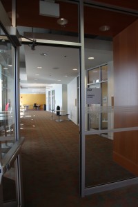
Webcast sponsored by the Irving K. Barber Learning Centre. Hosted by St. John’s College. Moderated by St. Johns College Alumnus, Asad Kiyani, this panel features experts who will discuss the global implications of the recent death of Osama Bin Laden. This panel includes Dr. Jon Beasley-Murray (UBC French, Hispanic, and Italian Studies); Dr. Maxwell A. Cameron (UBC Political Science); Ivan Somlai (Centre for Asia Pacific Initiatives, University of Victoria); and Alnoor Gova (UBC Education). This event took place at St. John’s College, Fairmont Social Lounge on Thursday, June 2, 2011.
Speaker Biographies
Asad Kiyani is a PhD Candidate in the Faculty of Law at the University of British Columbia. His research focuses on the development of modern international criminal law, and the legitimacy of the International Criminal Court. He is specifically interested in the intersection between international law and criminal law, and the justification of punishment in the international context.
Dr. Jon Beasley-Murray is a Professor at the University of British Columbia in the department of French, Hispanic, and Italian Studies and in the Arts One Program. Some of his research interests include Latin American cultural, literary, and political history, The Latin American left and social movements, Colonial Latin America and its maritime links with Spain, The theory and practice of Latin American cultural studies. For more information, please visit Dr. Beasley-Murray’s website: http://blogs.ubc.ca/jbmurray/
Dr. Maxwell A. Cameron is Professor of Political Science at the University of British Columbia. He specializes in comparative politics (Latin America) and international political economy. In addition to publishing numerous works, Dr. Cameron is a Distinguished Scholar in Residence at the Peter Wall Institute for Advanced Studies (2011-12) where he organized a colloquium series Aristotle’s idea of “practical wisdom” and its relevance in politics today.
Ivan Somlai is an Associate at the University of Victoria’s Centre for Asia-Pacific Initiatives. Since September 2006, he has been Director of Global Collaboration, through which he pursues international development consulting. His preferred areas are rural health systems and services; social forestry; ecotourism; multiculturalism; decentralisation; governance; executive leadership training; alternative conflict mitigation; motivation of multidisciplinary/intercultural teams; and ethnobureaucratic analysis. For more information about Ivan Somlai, please visit: http://www.capi.uvic.ca/content/somlai
Alnoor Gova is PhD candidate in the Faculty of Education. His research focuses on the present Canadian political scene, largely in the areas of Citizenship, Multiculturalism, Immigration, National Security and Law; and specifically focuses on an instrument of governmentality known as ‘community-government’ employed within the not-for-profit sector.
Select Books and Articles Available at UBC
Beasley-Murray, Jon. (2010). Posthegemony. Minneapolis: University of Minnesota Press. [Link]
Cameron, Maxwell A. (2012). After the Democratic Charter’s First Decade: Achievements, Limitations, and Next Steps. Latin American Policy, Vol. 3, no. 1, 2012, pp. 58-73. [Link]
Gova, Alnoor; Kurd, Rahat. (2008). The Impact of Radical Profiling: a MARU Society/UBC Law Faculty Study. Working Paper Series, Vol. 8-14.
UBC Library Research Guides
